|
 |
Each map will have a specific purpose or objective - for example to increase cycling and walking, or to promote cycle tourism. The design of the map itself needs to reflect this objective and who the map is intended for. Thus a map of routes to school should feel different to one aimed at commuters or long-distance cycle tourers.
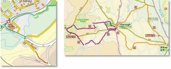
Working together with our clients, we use the best technology available to create the most appropriate format and to any specification. This can vary from a folded A4 walking map of a city centre at a scale of 1:10,000, to an A1 map of the National Cycle Network at 1:1,250,000.
We have experience in dealing with maps at all scales and using all the common formats used by Ordnance Survey.
Our designers take responsibility for all aspects of the production process from the initial brief through to delivery, keeping the client informed throughout.
|
 |
|